

Nepal Trekking Safety After the August 2026 Rasuwa Floods: What Trekkers Need to Know
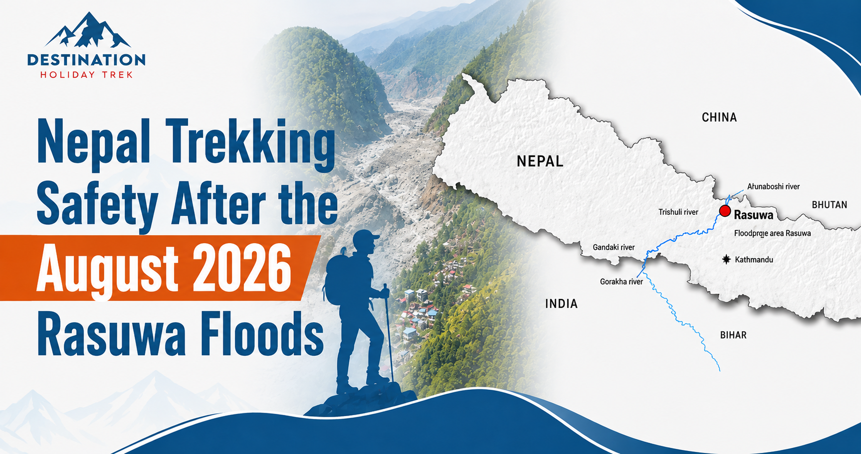
Table of Content
Introduction
Nepal trekking safety after the Rasuwa flood is the question most travelers are asking right now, and it deserves a clear, honest answer. On August 26, 2026, a massive flash flood tore through Rasuwa district after an ice and rock avalanche struck the Bhote Koshi River near the Nepal China border. Roads, bridges and settlements along the Bhote Koshi and Trishuli corridor were badly damaged, and rescue teams were still working when this article was published.
Nepal is not one single trekking destination. It is a country of separate mountain valleys and river systems, so a disaster in one corridor does not automatically apply everywhere. Based on information available as of August 30, 2026, the flood’s direct impact is concentrated in Rasuwa and Nuwakot, mainly affecting access to Langtang. Everest, Annapurna and Manaslu are currently reported as operating outside that corridor. Conditions can change quickly, so everything in this article should be confirmed again close to your departure date.
Quick Safety Summary
- The flood struck Rasuwa district on the morning of August 26, 2026, after a glacier or rock avalanche blocked a tributary near the Nepal Tibet border.
- Rasuwa, Nuwakot and downstream areas along the Trishuli corridor took the worst damage to roads, bridges and settlements.
- Langtang trekking access, reached through Syabrubesi in Rasuwa, is the route most directly affected and needs fresh confirmation before departure.
- Everest, Annapurna and Manaslu sit in different river valleys and are currently reported as operating outside the directly affected flood corridor.
- Kathmandu city and Tribhuvan International Airport were not in the flood’s path and continue normal flight operations.
- Road access in and around Rasuwa remains severely disrupted, and conditions may change without notice.
What Happened in Rasuwa on August 26, 2026?
A sudden surge of water, ice and rock hit the Bhote Koshi River on the morning of August 26, most likely after an avalanche formed a temporary barrier lake that then burst. Nepal’s hydrology authorities reported no significant local rainfall in the prior 24 hours, which pointed officials toward a glacial or landslide origin rather than ordinary monsoon rain. The flood wave moved at extreme speed, reaching downstream communities within minutes.
Rasuwagadhi, Timure and Syabrubesi in Rasuwa district took the worst damage, along with communities further downstream in Nuwakot and Dhading. The Gyirong Port border crossing was reportedly destroyed, multiple bridges were swept away, and long stretches of road along the Trishuli and Bhote Koshi corridor were cut or badly damaged.
Casualty figures have varied between sources and continued to change in the days after the disaster, which is normal during an active search and rescue effort. Early reports cited over 150 confirmed deaths, while later tracking cited several hundred deaths and well over a thousand people still missing. Treat any single figure, including ones in this article, as provisional, and check current reporting from Nepali authorities directly.
Is Nepal Still Safe for Trekking After the Rasuwa Flood?
Asking whether Nepal as a whole is safe is the wrong question. Trekking regions sit in different valleys with different rivers, roads and airports. Everest drains through the Dudh Koshi system in the east. Annapurna centers on the Kali Gandaki, Marsyangdi and Modi Khola in the west. Manaslu is reached from Gorkha district through Arughat, a separate corridor from Rasuwa. A serious disaster in one district does not automatically close every trekking region in the country.
The better questions to ask about your own trip are simple: which region and trail am I on, which road or flight gets me there, has the Nepal Tourism Board or my agency confirmed current access, and are the bridges and roads on my specific route intact right now. Answering these for your own itinerary gives a far more useful answer than treating Nepal as one block.
Which Trekking Regions Were Affected?
| Trekking Region | Current Situation | Main Concern | What Trekkers Should Do |
| Langtang | Access route through Rasuwa and Syabrubesi directly affected | Damaged roads and bridges on the approach | Confirm current access with your agency before booking or departing |
| Everest (Khumbu) | Currently reported as operating, outside the flood corridor | Normal late monsoon weather and Lukla flight delays | Confirm Lukla flight status close to departure |
| Annapurna (Circuit, Base Camp, Poon Hill, Mardi Himal) | Currently reported as operating, outside the flood corridor | Localized monsoon season landslide and road risk | Check road conditions to Pokhara and trailheads before travel |
| Manaslu | Currently reported as operating, separate approach via Arughat | Restricted area permit rules and monsoon road conditions | Travel with a licensed agency and confirm current road access |
| Kanchenjunga | No reported impact | Remote region with limited real time reporting | Confirm current conditions with a licensed operator |
| Makalu | No reported impact | Remote region with limited real time reporting | Confirm current conditions with a licensed operator |
| Dolpo (Upper and Lower) | No reported impact | Restricted area, limited communication infrastructure | Confirm conditions and permit status before departure |
| Mustang and Tilicho Lake area | Currently reported as operating, Pokhara to Jomsom flights resumed | Monsoon season weather in the wider region | Confirm flight schedules shortly before your trip |
No region above should be read as guaranteed safe. Available information indicates conditions are subject to weather and local circumstances, and trekkers should confirm current access before departure.
Langtang Trek After the Rasuwa Flood
Langtang deserves special attention because Rasuwa district is not incidental to this trek, it is the gateway to it. The standard route runs from Kathmandu through Trishuli and Dhunche to Syabrubesi, a community named directly in flood damage reports and in official road closure alerts. That approach road has been reported blocked, and authorities have advised postponing travel to Rasuwa, including Syabrubesi and Langtang access routes, until conditions are confirmed.
There is a difference between the flood affected corridor near Syabrubesi and the trekking trail further up the Langtang valley, but that distinction does not help if the access road itself is not open. No trekker should assume an alternative route exists without direct confirmation from Nepali authorities and a licensed trekking team. If you have a Langtang Valley Trek booked, treat your itinerary as on hold until your agency confirms in writing that the road, bridges and trail are open.
Is Everest Base Camp Trek Safe After the Rasuwa Flood?
The Everest region and Rasuwa district are geographically separate. Everest region trekking drains into the Dudh Koshi river system in eastern Nepal, which has no connection to the Bhote Koshi and Trishuli corridor hit by the flood. Based on available information, Lukla flights and Khumbu trails have not been reported as affected by the August 26 event.
This does not mean the route is free of ordinary risk. Late August and September fall within Nepal’s monsoon season, which regularly brings rain and occasional landslide activity to mountain roads and trails, entirely apart from the Rasuwa disaster. Trekkers planning an Everest Base Camp Trek should still build flexibility into their schedule for weather delays, and the same applies to longer routes such as the Everest Three Pass Trek or the Gokyo Trek.
Is the Annapurna Region Safe for Trekking?
The Annapurna region sits west of the Rasuwa flood corridor and drains through separate river systems. Current reporting indicates Pokhara to Jomsom flights resumed on August 26, and the main Annapurna trailheads have not been named among the roads closed by Nepali authorities.
Being outside the Rasuwa flood zone is not the same as being risk free. Monsoon season landslide activity on approach roads to Nayapul, Ghandruk or Besisahar is a normal seasonal issue, unrelated to the Rasuwa event, and current conditions should still be checked before travel. Trekkers can currently plan for the Annapurna Circuit Trek, the Annapurna Base Camp Trek, the shorter Ghorepani Poon Hill Trek, or the Mardi Himal Trek, while confirming conditions shortly before departure.
Is the Manaslu Circuit Trek Safe?
Manaslu is sometimes confused with the Rasuwa disaster zone because both sit in west central Nepal, but the standard approach runs through Gorkha district via Arughat, not through Rasuwa. Based on available information, this route has not been reported as affected by the August 26 flood.
Manaslu still carries its own normal seasonal considerations. It is a restricted area requiring a special permit and travel with a licensed agency, and late monsoon rain can affect the Arughat approach road in a typical year, independent of the current disaster. Trekkers considering the Manaslu Circuit Trek should confirm current permit rules directly with a licensed operator, and those wanting a more demanding extension can also check current conditions on the Dhaulagiri Circuit Trek.
What Are the Main Safety Risks for Trekkers After the Flood?
Flash Floods
Never camp beside a river, and never cross a stream running high, fast or discolored with sediment. Flash floods can rise with almost no warning.
Landslides and Rockfall
Slopes can stay unstable for weeks after heavy rain, even where no major disaster has occurred, so trails cut into steep hillsides need extra caution.
Damaged Bridges and Roads
Never cross a bridge that shows visible damage, and never bypass an official closure, even if a shortcut looks possible.
Unstable Mountain Slopes
Ground recently disturbed by a landslide or flood needs a wider margin of caution than terrain that has been stable for a long period.
Weather Changes
Himalayan weather can shift quickly, especially at altitude during the monsoon to post monsoon transition in September.
Altitude Sickness
This is separate from flood safety. Any trek above roughly 2,500 to 3,000 meters carries a real risk of acute mountain sickness, and standard precautions such as gradual ascent still apply.
Communication Problems
Mobile coverage in mountain areas is limited even in normal conditions. Carry a charged phone and a power bank, and ask your agency what backup communication is available.
Emergency Evacuation
Confirm your travel insurance specifically covers high altitude trekking and helicopter evacuation, since many standard policies exclude this.
How Trekkers Can Prepare Before Leaving Kathmandu
| Item | Why It Matters | What to Check |
| Official travel advisories | Conditions change quickly during an active disaster response | Latest guidance from your country’s foreign ministry and the Nepal Tourism Board |
| Road and trail conditions with your agency | Local operators have the most current, route specific information | A written status update within days of departure, not weeks in advance |
| Accommodation availability | Some lodges may be affected by damage or rerouted traffic | Confirmation that lodges on your route are open and reachable |
| Permits | Rules and fees are set by Nepali authorities and can change | Current requirements through the Nepal Tourism Board or TAAN |
| Weather forecasts | Monsoon transition weather affects flights and trails | Department of Hydrology and Meteorology forecasts for your dates |
| Itinerary shared with family | Enables faster contact in an emergency | Share your route, dates, agency name and emergency contacts |
| Travel insurance documents | Needed for medical treatment or evacuation claims | Confirm coverage for trekking altitude and helicopter evacuation |
| Emergency contact details | Needed if normal communication is disrupted | Carry embassy contacts, your agency’s line and rescue hotline numbers |
| Power bank and charging plan | Mountain lodges have limited or paid charging | Confirm charging availability and carry a spare power bank |
| Rain protection and layers | Monsoon transition weather brings sudden rain and cold | Waterproof jacket, pack cover and layered clothing |
| Basic first aid supplies | Medical help can be hours away on mountain trails | A kit covering blisters, minor injuries and personal medication |
| Flexibility in your itinerary | Flight delays and route changes are common | Build one or two buffer days before international connections |
Trekking Permits and Documents After the Flood
A disaster in one district does not remove Nepal’s normal permit requirements elsewhere. Most major routes, including Everest, Annapurna and Manaslu, still require the applicable permits, such as the TIMS card, area specific permits through the Nepal Tourism Board, and conservation area e permits through the National Trust for Nature Conservation. Manaslu, Upper Dolpo and some other regions require restricted area permits arranged through a licensed agency.
Permit fees and rules can be revised, so check current information directly through the Nepal Tourism Board’s trekking permit page, the National Trust for Nature Conservation’s e permit portal, or the Trekking Agencies’ Association of Nepal’s permit fee page. If your passport requires a visa, current rules are available through Nepal Immigration’s visa information page. If your route touches a controlled area near the Nepal China border, ask your agency whether current access rules have changed.
What Should You Do If Conditions Become Unsafe?
- Stop and assess the situation before continuing.
- Move away from rivers, riverbanks and unstable slopes to higher ground.
- Follow instructions from local authorities and your guide without delay.
- Contact your trekking agency or guide immediately to report your status.
- Never attempt to cross a damaged bridge or floodwater.
- Move to designated safe areas when instructed.
- Contact emergency or rescue services when necessary.
- Keep your passport, insurance documents and emergency contacts in one accessible place.
Nepal’s official rescue and emergency coordination information is available through the government’s rescue portal, and the U.S. Embassy in Kathmandu has published a dedicated update on Rasuwa flooding and major road closures worth reviewing if your route touches that district.
Conclusion
The lesson from the August 2026 Rasuwa flood is not that Nepal is unsafe, and it is also not that every region outside Rasuwa is guaranteed trouble free. It is that trekkers need to evaluate their specific route, access road, current weather and official guidance individually, rather than treating one disaster in one river corridor as a verdict on the entire country. A Langtang itinerary and an Everest Base Camp itinerary depend on completely different roads, rivers and communities, and they should be assessed separately.
If you are planning a trek in the coming weeks and want help checking current conditions for your route, Destination Holiday Trek can review your itinerary against the latest available information on road access, permits and trail conditions before you commit to dates. This applies to the Everest Base Camp Trek, the Annapurna Base Camp Trek, the Manaslu Circuit Trek, a shorter option such as the Pikey Peak Trek, or a more remote route such as the Lower Dolpo Trek or Upper Dolpo Trek. Whatever route you are considering, confirm current conditions with a licensed local operator before you leave Kathmandu, and keep your plans flexible.
Frequently Asked Questions
- Is Nepal safe for trekking after the August 2026 Rasuwa flood?
Nepal as a whole has not been closed to trekking. The flood’s direct impact is concentrated in Rasuwa district, mainly affecting Langtang. Everest, Annapurna and Manaslu are currently reported as operating outside that corridor. Confirm the current status of your specific region and route before departure rather than judging Nepal as one block. - Is Langtang Valley Trek safe after the Rasuwa flood?
Langtang is the region most directly affected, since its access route runs through Syabrubesi in Rasuwa, an area named in official road closure alerts. Road access remains disrupted and can change without notice. Get written confirmation of current conditions from your agency before committing to dates. - Is Everest Base Camp Trek affected by the Rasuwa flood?
Based on available information, no. The Everest region drains into the separate Dudh Koshi system and has not been named in flood related closures. Lukla flights and Khumbu trails are currently reported as operating normally, subject to ordinary monsoon season weather delays. - Is Annapurna trekking safe in 2026?
The Annapurna region sits outside the directly affected flood corridor, and Pokhara to Jomsom flights and the main trailheads are currently reported as operating. Monsoon season landslide activity on approach roads is a normal seasonal concern, so current road and weather conditions should still be checked before departure. - Is Manaslu Circuit Trek open after the Rasuwa flood?
Available information indicates the Manaslu access route through Gorkha and Arughat is separate from the Rasuwa corridor and has not been reported as affected. As a restricted area trek, it still requires a special permit and a licensed agency, and normal monsoon season road checks around Arughat apply. - Can I trek in Nepal in September 2026?
Trekking in most major regions is currently reported as continuing through September 2026, subject to normal monsoon transition weather and evolving conditions in Rasuwa. September typically sees monsoon rain ease through the month, but this should be confirmed against current conditions for your route. - Should I cancel my Nepal trek because of the Rasuwa flood?
If your itinerary depends on the Rasuwa corridor, particularly Langtang or an overland route through Rasuwagadhi, postponement or rerouting is currently the more cautious choice until access is confirmed. If your itinerary is in Everest, Annapurna, Manaslu or another region outside that corridor, available information does not indicate a need to cancel. - What should trekkers check before traveling to Nepal?
Check current official travel advisories, get a written status update from your agency close to departure, confirm your permits and visa requirements, check weather forecasts, and confirm your travel insurance covers trekking altitude and helicopter evacuation. Share your itinerary with someone at home and carry emergency contacts, a power bank and basic first aid supplies.