

Is the Lower Dolpo Trek Hard? Full Difficulty Guide
Table of Content
Introduction
Lower Dolpo is not a technical climb, but it is one of the harder trekking routes in Nepal. The difficulty comes from a combination of things: two passes above 5,000 metres, several long days on rough trail, a short supply of facilities, and a flight dependent approach through a restricted area. None of these is extreme alone. Together they make Lower Dolpo a trek that rewards preparation and punishes casual planning.
This guide covers what the difficulty actually looks like day to day, so you can decide whether the route suits you before you book.
How Hard Is the Lower Dolpo Trek?
Short answer: Lower Dolpo is a hard, high altitude trek that needs good fitness and sensible preparation. It does not need climbing skills, ropes or ice axes. Fit first time trekkers can complete it if they train properly and take a well paced itinerary seriously, but it is not the route most people would choose as their very first Himalayan trek.
Operators grade it differently. Some list it as moderate, others as strenuous, and our own trip page grades it as hard. The gap exists because there is no official difficulty scale for Nepal treks. What matters is understanding what is behind the label:
| Factor | Summary |
| Altitude | Passes above 5,000 m, with a few nights above 4,000 m |
| Terrain | Rocky, uneven, steep in places, with exposed sections |
| Daily walking | Frequent 5 to 7 hour days on the main itinerary |
| Pass crossings | Numa La and Baga La on the standard route |
| Remoteness | Very limited facilities, no road access in the main section |
| Accommodation | Mix of basic teahouses and camping |
| Length | Around 15 to 25 days depending on the plan |
For beginners, the honest summary is that it is possible but demanding. For experienced trekkers, it is a manageable but serious route. For anyone with previous high altitude experience, it is a very rewarding step into remote trekking.
Why Is the Lower Dolpo Trek Considered Difficult?
The reputation comes from several factors stacking up rather than one dramatic obstacle. Here is each one in turn.
High Altitude
The route climbs from the Juphal and Dunai area, at roughly 2,150 to 2,475 metres, to two passes above 5,000 metres. Numa La and Baga La are the key high points. Published pass heights vary between operators and maps. Numa La appears anywhere from about 5,159 m to about 5,360 m, and Baga La from about 5,070 m to about 5,190 m. The variation comes from different surveys, GPS readings and rounding, so treat any single number as approximate.
What matters more than the exact figure is the profile. The trail gains height steadily through the Tarap valley, spends several nights at 3,900 m to 4,500 m, and then crosses two passes on back to back days. After that it drops to Phoksundo Lake at about 3,611 m.
Altitude affects everyone differently, and fitness does not reliably protect you from it. Common symptoms of altitude sickness include headache, nausea, poor appetite, dizziness, unusual fatigue and disturbed sleep. A rest day at Dho Tarap in the main itinerary gives your body time to adjust before the passes, and that rest day matters more than most trekkers realise.
If you are comparing itineraries, look closely at where acclimatization time is built in. Our Lower Dolpo Trek itinerary includes a full rest day at Dho Tarap before the Numa La approach.
Long Walking Days
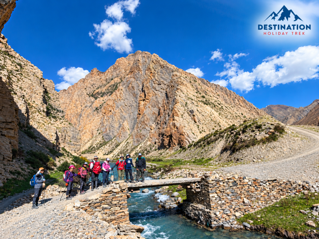
The main challenge is not a single hard day. It is the sequence of long days in a row. On the standard route, days of 5 to 7 hours are common, and the days around the two passes are among the longest.
Many trekkers underestimate this. A 6 hour day at 4,000 metres feels very different from a 6 hour day at home, because pace slows, breaks become more frequent and recovery is slower. The third or fourth long day in a row is usually where tiredness shows up.
Challenging Himalayan Terrain
The terrain is rugged rather than technical. Expect:
- Rocky trail with loose stones and scree sections
- Narrow paths cut into steep hillsides, some with drop offs
- Steep ascents and descents, including long descents that are hard on knees
- Suspension bridges and river crossings along the Tarap Chu and Thulo Bheri valleys
- Dry, windy open ground above the tree line
- Variable trail conditions after rain or snow, with washouts or snow cover near passes
Trekking poles help a great deal on the descents.
Remote and Isolated Region
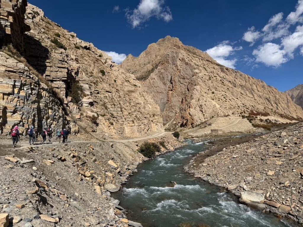
Remoteness is a difficulty factor in its own right. Dolpo has no road access along the main trekking section, and the approach itself depends on flights to Nepalgunj and then Juphal. Facilities are limited, and the further you go from Dunai the more self reliant the trek becomes.
Practical effects include:
- Mobile network is patchy or absent for most of the route
- Medical facilities are limited, so a serious problem often means evacuation
- Food, fuel and supplies are limited, so camping crews carry much of what is needed
- Weather can delay flights, which affects both the start and the exit
This is why trekking logistics matter so much here. Our guide to restricted area trekking in Nepal explains how this type of trip is organised.
Weather and Seasonal Conditions
Weather affects visibility, trail condition, temperature and flights. Dolpo sits in the rain shadow of the Dhaulagiri range, so it is drier than many other parts of Nepal. Even so, conditions change quickly at altitude. Cold mornings, strong afternoon winds and sudden snow near the passes are all possible.
Spring (March to May) and autumn (September to November) are the main trekking seasons and are generally the most stable. Some operators run treks in other months, but flights, snow on the passes and cold camping conditions can all become harder to manage. Details are covered in the season section below.
Lower Dolpo Trek Difficulty at a Glance
| Difficulty Factor | What to Expect | Difficulty Level | Why It Matters |
| Altitude | Two passes above 5,000 m, several nights above 4,000 m | High | Altitude sickness is the main medical risk |
| Terrain | Rocky, uneven, steep sections, some narrow paths | Moderate to high | Slows pace and tires legs on descents |
| Daily walking | Commonly 5 to 7 hours on many days | Moderate to high | Fatigue builds across consecutive days |
| Pass crossings | Numa La and Baga La on back to back days | High | Two big climbs in a short window |
| Weather | Cold, windy, variable, snow possible near passes | Moderate to high | Can affect safety, comfort and schedule |
| Accommodation | Basic teahouses and tented camps | Moderate | Less comfort, colder nights, basic facilities |
| Remoteness | Limited facilities, no road access, patchy communication | High | Evacuation and support take longer |
| Fitness requirement | Good cardiovascular fitness and leg strength | High | Training before arrival makes a real difference |
| Technical climbing | Not required on the standard trekking route | None | No ropes, crampons or ice axe use is normally needed |
Some itineraries and some seasons may call for micro spikes or similar traction if there is snow on the passes. That is different from technical climbing.
Lower Dolpo Trek Altitude and Elevation Gain
Elevations differ slightly between sources, so the table gives approximate figures based on a common route direction and our own itinerary, with ranges where published figures disagree.
| Location | Approximate Elevation | Difficulty Consideration |
| Kathmandu | About 1,350 m | Start point, no altitude concern |
| Nepalgunj | About 150 m | Hot, low elevation overnight stop |
| Juphal | About 2,400 to 2,475 m | Flight arrival, modest altitude |
| Dunai | About 2,150 m | District centre, easy first night |
| Tarakot | About 2,540 to 2,600 m | Gradual climb, moderate walking |
| Laini Odar (Lahini) | About 3,375 to 3,500 m | Higher night, climb begins in earnest |
| Nawarpani | About 3,950 m | Close to 4,000 m, longer day |
| Dho Tarap | About 4,040 to 4,090 m | Acclimatization rest day location |
| Numa La Base Camp | About 4,350 to 4,440 m | Cold camp before the first pass |
| Numa La | About 5,159 to 5,360 m | Highest point, hard climbing day |
| Pelung Tang | About 4,465 m | Camp after Numa La |
| Baga La | About 5,070 to 5,190 m | Second pass, tired legs |
| Dajok Tang | About 4,080 m | Descent day |
| Ringmo | About 3,600 m | Lower altitude, easier walking |
| Shey Phoksundo Lake | About 3,611 m | Lower elevation, rest and exploration |
| Shyanta | About 2,520 m | Long descent toward the exit |
The body responds to altitude gain over time, not just to the height reached. The reason for the rest day and the gradual rise through the Tarap valley is to give your body time to produce more red blood cells and adjust breathing and heart rate. Rushing this process is the most common reason people struggle on high treks.
How Many Hours Do You Walk Each Day on the Lower Dolpo Trek?
There is no single fixed answer, because itineraries vary. The table below uses typical walking times from our 17 day route, and notes where operators publish different figures.
| Day Type | Typical Walking Time | Example |
| Short | About 3 to 4 hours | Dajok Tang to Ringmo |
| Moderate | About 4 to 5 hours | Juphal flight day walk to Dunai, afternoon only |
| Moderate to long | About 5 to 6 hours | Dunai to Tarakot, Tarakot to Laini Odar, Phoksundo to Shyanta |
| Long | About 6 to 7 hours | Laini Odar to Nawarpani, Nawarpani to Dho Tarap, Numa La, Baga La |
Some operators list the Dho Tarap to Numa La Base Camp day as 4 to 5 hours, and ours lists 6 to 7. The difference comes from where each group camps and how the stage is split. Always check the exact camp locations rather than relying on hours alone.
Walking hours also change depending on pace, group fitness, weather and trail conditions. Hours include short breaks but usually not a full lunch stop.
Lower Dolpo Trekking Route and Its Most Difficult Sections
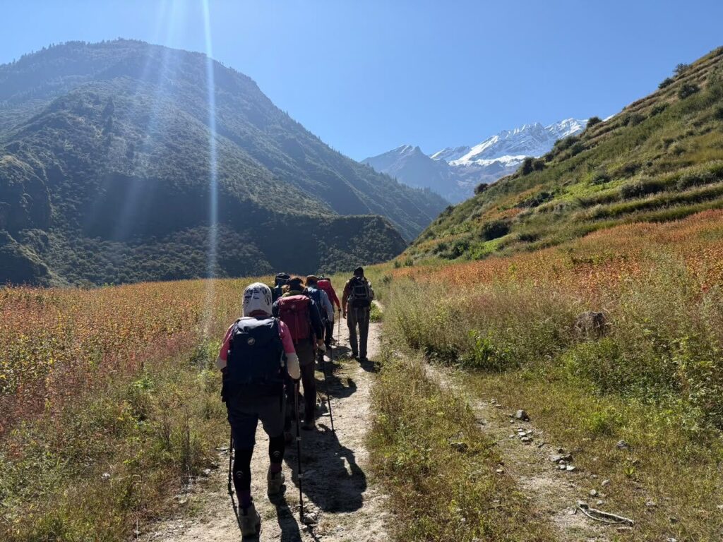
The standard route follows the Bheri and Tarap valleys to Dho Tarap, crosses Numa La and Baga La, and finishes at Phoksundo Lake before returning to Juphal. Some route versions also cross Kagmara La at about 5,115 m, so confirm which version your operator uses.
The sections most trekkers find hardest are:
The climb from Laini Odar to Dho Tarap. The trail climbs steadily through a narrowing valley with repeated ascents and descents. It is not a pass day, but the altitude is now above 3,900 m and the days are long.
Numa La. This is usually the toughest day. It starts early, often in cold conditions, and climbs steeply to above 5,000 m before a long descent to Pelung Tang. Because the distance is not huge but the height gain and loss are large, it feels more demanding than the map suggests.
Baga La. The second pass comes straight after Numa La. Legs are tired, the climb is again steep, and the descent to Dajok Tang is long. Trekkers often report that this day tests mental stamina as much as fitness.
The descent to the lake and exit. After the passes the trail is easier on lungs but still hard on knees. The final days also depend on flight timing.
Fitness Level Required for the Lower Dolpo Trek
You do not need to be an athlete, but you do need a solid base. The most useful qualities are:
- Cardiovascular endurance: the ability to keep moving for 5 to 7 hours at a steady pace
- Leg strength: especially quadriceps and calves for steep ascents and descents
- Hiking stamina: comfort with consecutive long days, not just one big effort
- Recovery: the ability to wake up and walk again after a hard day
- Descent control: strength to handle long downhill sections without knee pain
- Altitude readiness: a sensible attitude to pace, hydration and reporting symptoms
Technical mountaineering skills are not normally required. The standard trekking itinerary does not involve roped climbing, glacier travel or technical ice. If a specific itinerary adds extra passes or snow sections, the operator should say so clearly.
Can Beginners Do the Lower Dolpo Trek?
It depends on what kind of beginner you are.
| Beginner Type | Realistic Outlook |
| Complete beginner with little hiking experience | Not recommended as a first trek. Build experience on a shorter route first. |
| Physically fit beginner | Possible with serious training, a well paced itinerary and good support, but demanding. |
| Someone with previous multi day trekking | Realistic. Altitude is the main new factor. |
| Experienced high altitude trekker | Well suited, and the remoteness is often the main new challenge. |
A beginner who is fit, trains for several months, gets used to hiking with a loaded pack and accepts the pace of a long trek can finish this route. What makes it realistic is preparation, not luck. What makes it unrealistic is arriving with no training and hoping the guides will carry you through.
If you are unsure, contact our trekking team with your experience and we can give an honest view on whether Lower Dolpo is right now or whether a shorter high altitude trek would be a better first step.
How to Prepare for the Lower Dolpo Trek
A simple plan starts three to four months before departure.
Cardiovascular Training
Aim for three sessions a week of running, cycling, brisk walking or swimming. Build from 30 minutes to 60 or 90 minutes. The goal is the ability to stay comfortable at moderate effort for hours.
Strength Training
Twice a week, focus on squats, lunges, step ups, calf raises, core work and glute exercises. Strong legs make descents safer and reduce knee fatigue.
Hiking Practice
Hike on weekends with increasing distance and elevation. Include at least a few back to back long days, because Lower Dolpo is about repeated effort.
Stair and Uphill Training
If you live somewhere flat, use stairs, a stair machine or a treadmill on incline. Steady uphill work builds the specific strength you need on the passes.
Backpack Preparation
Even if porters carry your main bag, you will carry a day pack with water, layers, snacks, camera and personal items. Train with a pack at a similar weight so shoulders and hips adapt.
Altitude Preparation
You cannot fully train for altitude at sea level, but you can prepare sensibly. Spend time at elevation beforehand if possible, sleep well, arrive in Nepal rested, and discuss any medical concerns with a doctor before departure. Questions about preventive medication should go to a qualified medical professional.
Mental Preparation
The route is as much about patience as strength. Expect cold mornings, basic food, dust, wind and some days that feel slow. Trekkers who accept that tend to enjoy the trip more.
Simple Preparation Timeline
| Time Before Trek | Focus |
| 16 to 12 weeks | Build a base: cardio three times a week, start strength work |
| 12 to 8 weeks | Add longer hikes, stairs and uphill work |
| 8 to 4 weeks | Back to back long hikes with a loaded pack, test boots and gear |
| 4 to 2 weeks | Peak training, then begin to taper |
| Final week | Rest, sleep well, check gear and insurance |
What Makes Lower Dolpo Different From Other Nepal Treks?
The comparison below is based on commonly published figures and general trekking conditions. It is not an official grading.
| Factor | Lower Dolpo | Everest Base Camp | Annapurna Base Camp | Manaslu Circuit | Upper Dolpo |
| Highest point | Passes about 5,100 to 5,350 m | Base camp about 5,364 m, Kala Patthar about 5,545 m | About 4,130 m | Larkya La about 5,106 m | Multiple passes above 5,000 m |
| Remoteness | Very high | Moderate, busy trail | Moderate | High | Very high |
| Terrain | Rugged, dry, rocky | Well worn trail, rocky higher up | Steps, forest, valley | Mixed, long approach | Rugged, remote |
| Typical walking time | 5 to 7 hours on many days | 4 to 7 hours | 4 to 7 hours | 5 to 8 hours | 5 to 8 hours |
| Accommodation | Teahouses and camping | Teahouses | Teahouses | Teahouses | Mostly camping |
| Pass crossings | Two main passes | None on the standard route | None | One main pass | Several |
| Restricted permit | Yes | No | No | Yes | Yes |
Lower Dolpo stands out because it combines altitude with remoteness and limited infrastructure. Everest Base Camp reaches a similar altitude but has far more lodges, more traffic and easier access to help.
Lower Dolpo Trek Difficulty by Experience Level
| Trekker Type | Can They Do It? | Preparation Needed |
| First time trekker | Possible only with strong fitness and dedicated training | Several months of hiking, strength and endurance work, plus honest advice from the operator |
| Regular hiker | Yes, with preparation | Focus on altitude, back to back days and descent strength |
| Experienced Nepal trekker | Yes, comfortably for many | Check pacing and remote logistics |
| Experienced high altitude trekker | Well suited | Focus on remoteness, camping comfort and weather planning |
Is Lower Dolpo Harder Than Everest Base Camp?
It depends on what you mean by harder.
Everest Base Camp reaches a high altitude, and the final nights are cold and thin on oxygen, but the trail is well established, lodges are frequent and rescue is relatively accessible. Lower Dolpo reaches similar pass heights, but the route is more remote, the facilities are fewer, and you cross two passes rather than ending at a single high point.
Trekkers who like busy, social routes often find Everest easier on logistics but crowded. Trekkers who value solitude often prefer Lower Dolpo but find it more demanding in planning and self reliance. Neither is simply harder. Your fitness, acclimatization history and itinerary matter more than the label.
Many people compare the options through our wider Nepal trekking experiences before deciding.
Is Lower Dolpo Harder Than Annapurna Base Camp?
Yes, in most respects. Annapurna Base Camp reaches about 4,130 m, so the altitude is much lower, and it has regular teahouses, shorter remote stretches and no pass crossings. Lower Dolpo has higher altitude, longer days, camping sections and much less infrastructure.
Annapurna Base Camp is a good fit for a first Himalayan trek. Lower Dolpo is better as a second or third trek, after you know how your body responds to altitude.
What Should You Pack for a Difficult Trek Like Lower Dolpo?
Pack for cold, wind, sun and basic conditions. The list below is a practical core, not a shopping list.
- Trekking boots: well broken in, waterproof if possible, with good ankle support
- Layered clothing: thermal base layers, fleece or mid layer, down jacket, windproof and waterproof shell
- Lower body: trekking trousers, waterproof trousers, and warm trousers for camp
- Sleeping equipment: a warm four season sleeping bag suitable for freezing nights, with rental available through some operators
- Waterproof gear: rain jacket, rain cover for your pack, dry bags
- Trekking poles: especially useful on long descents
- Headlamp: with spare batteries
- Water purification: tablets or a filter
- First aid supplies: blister care, pain relief, personal medication, rehydration salts
- Sun protection: sunglasses, high SPF sunscreen, lip balm, hat
- Warm accessories: gloves, warm hat, buff, spare socks
- Navigation and communication: guides normally carry route knowledge and emergency communication, but a power bank and offline map are useful
- Traction: micro spikes may be useful in spring or late autumn if snow is present on the passes
Leave unnecessary items at home. Weight matters on long days.
Altitude Sickness and Safety on the Lower Dolpo Trek
Altitude sickness occurs when the body does not adjust quickly enough to lower oxygen levels. Mild symptoms include headache, nausea, dizziness, poor sleep and fatigue. These can often be managed by resting, drinking fluids and not climbing higher until symptoms ease.
More serious signs include severe headache, confusion, loss of balance, breathlessness at rest, persistent vomiting or a cough that gets worse. These need immediate attention and often mean descending.
A few principles apply:
- Gradual ascent gives your body time to adapt
- Report symptoms early to your guide instead of hiding them
- Do not continue climbing with worsening symptoms
- Descending is the most reliable response to serious altitude illness
- Evacuation may be needed, and weather can delay it
Talk to a doctor before the trek, especially if you have heart, lung or other health conditions, or if you are considering preventive medication. Travel insurance should explicitly cover trekking at high altitude and emergency evacuation.
Permits Required for Lower Dolpo Trek
Lower Dolpo is a restricted area, so you need special permits. In practice these are:
- A Lower Dolpo restricted area permit issued through Nepal immigration
- A Shey Phoksundo National Park entry permit
Published figures vary. Many 2026 sources list the Lower Dolpo restricted permit at around USD 20 per person per week, with a smaller daily extension beyond the first week, while older sources list USD 10 per week. The national park permit is commonly listed at NPR 3,000 for foreign nationals. Rules and fees can change, and some sources report changes to solo trekking rules in restricted areas in 2026. Always check the official Nepal immigration trekking route and permit fee page and confirm with your operator before booking.
Permits are arranged through a registered trekking company, which is also why most Lower Dolpo trips include them in the price. Upper Dolpo permits are a separate and much more expensive category.
Best Season and Weather for Lower Dolpo
Spring (March to May): Temperatures rise gradually, rhododendron forests flower at lower elevations, and passes are often clearer than in winter. Early spring can still bring snow near the passes.
Autumn (September to November): Typically stable, clear and dry, with good visibility. Nights get colder as November approaches. This is a popular season.
Monsoon (June to August): Dolpo lies in the rain shadow, so some operators do run treks in this period. However, the approach can be affected by rain, landslides and flight delays, and trail and weather conditions vary. If you are considering this season, discuss it carefully with an experienced operator.
Winter (December to February): Cold, with snow on the passes and low night temperatures. Passes can become impassable, and camping is much harder. Most trekkers avoid this season.
Actual conditions vary year to year. Allow flexibility in your schedule because flights to Juphal in particular depend on weather.
How to Make the Lower Dolpo Trek Easier
- Choose a properly planned itinerary with a rest day before the passes
- Allow enough days so you are not rushing
- Train before arrival and not only in the last month
- Walk at a pace where you can still talk
- Drink steadily and eat even when appetite drops
- Pack well and keep your day pack light
- Listen to your guide and speak up early about symptoms
- Avoid pushing hard on the pass days
- Build a buffer day or two for weather and flights
Conclusion
So, is the Lower Dolpo Trek hard? Yes. It is a demanding Himalayan trek because of its altitude, remote terrain, long trekking days, limited facilities and logistical challenges. It is not technically difficult, and it does not require climbing skills.
With good preparation, proper acclimatization, realistic pacing, suitable equipment and experienced local support, it is manageable for trekkers who have trained and who respect the altitude. If you want to compare it with a longer and more remote route, our 25 day Upper Dolpo Trek is the natural next step after Lower Dolpo.
Lower Dolpo Trek Difficulty: FAQs
- Is Lower Dolpo Trek difficult?
Yes. It is a hard high altitude trek because of the passes above 5,000 m, long walking days and remote conditions. It is not technical, and prepared trekkers can complete it. - How fit do you need to be for Lower Dolpo?
You should be comfortable walking 5 to 7 hours for several days in a row, with good leg strength and cardiovascular fitness. Training for at least three to four months is sensible. - Is Lower Dolpo harder than Everest Base Camp?
In terms of remoteness and logistics, yes for many people. In terms of altitude, they are similar at the high points. Individual fitness and acclimatization matter more than any ranking. - Can beginners trek Lower Dolpo?
Fit beginners with serious preparation can, but it is not ideal for complete novices. A shorter high altitude trek first is often wiser. - How many hours do you walk each day in Lower Dolpo?
Commonly 5 to 7 hours on the main days, with some shorter days of about 3 to 4 hours. Times vary by itinerary and camp locations. - What is the highest altitude on the Lower Dolpo Trek?
The highest point is usually Numa La, published at roughly 5,159 to 5,360 m depending on the source. Baga La is also above 5,000 m. - Do you need previous trekking experience for Lower Dolpo?
It is strongly recommended. Previous multi day trekking, ideally with some altitude exposure, makes the trek much more manageable. - Is Lower Dolpo Trek suitable for older trekkers?
Healthy, fit older trekkers can do it, but a medical check, good conditioning and a conservative itinerary are important. - What is the best season for Lower Dolpo?
Spring (March to May) and autumn (September to November) are the main seasons. - Do you need special permits for Lower Dolpo?
Yes. You need a restricted area permit and a Shey Phoksundo National Park permit, arranged through a registered trekking company. Confirm current fees on the official immigration website.