- info@destinationholidaytrek.com
- +977-9768913779
- Gokarneshwor-6, Arubari, Kathmandu, Nepal
Annapurna I Expedition (8,091m)
Annapurna I Expedition (8,091m)
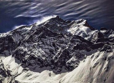
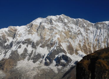
The Annapurna I Expedition is one of the most challenging and respected high-altitude mountaineering adventures in the world. Standing at 8,091 meters, Annapurna I is the 10th highest mountain on Earth and is renowned for its steep terrain, unpredictable weather, and serious avalanche risk. This expedition is recommended only for highly experienced climbers with strong technical skills and previous 7,000–8,000m peak experience.
Located in central Nepal, Annapurna I was the first 8,000-meter peak ever climbed, successfully summited in 1950. Despite its historical significance, it remains one of the least climbed due to its demanding nature. The route to the summit passes through remote valleys, massive glaciers, and exposed high camps that require careful planning and expert leadership.
The expedition usually begins in Kathmandu, followed by a scenic drive to the Annapurna region and a trek to Annapurna Base Camp (around 4,200m). From Base Camp, climbers establish a series of high camps and conduct multiple acclimatization rotations before attempting the summit during a short and carefully selected weather window.
The full expedition takes approximately 55–65 days, allowing time for acclimatization, route fixing, and summit attempts. Climbers are supported by professional expedition leaders, experienced high-altitude Sherpa guides, fixed ropes, safety systems, and well-organized logistics to maximize safety in this extreme environment.
Summiting Annapurna I is considered a rare and elite achievement in Himalayan mountaineering—symbolizing courage, discipline, and exceptional alpine skill.
Trip Highlights
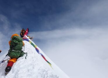
★ Summit the world’s 10th highest peak at 8,091m, one of the most iconic mountains in the Himalayas.
★ A challenging and technical climb, ideal for experienced mountaineers seeking a serious 8000-meter expedition.
★ Scenic helicopter flight or drive through beautiful Nepalese countryside to reach the trailhead.
★ Trek through the Annapurna Conservation Area, rich in biodiversity, forests, waterfalls, and traditional Gurung & Magar villages.
★ Excellent acclimatization trekking route with panoramic views of Annapurna Massif, Dhaulagiri, Machhapuchhre, Hiunchuli, and Nilgiri.
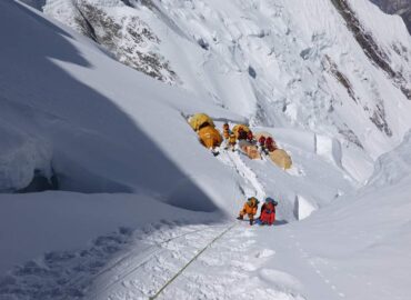
★ Climb through four high camps, mastering mixed terrain: snow, ice, and steep sections.
★ Professional Sherpa climbing guides with high-altitude expertise and safety support.
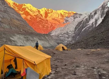
★ Experience remote Base Camp life, surrounded by dramatic icefalls, glaciers, and towering walls.
★ Opportunity to attempt one of the most respected and historic 8000m peaks, first climbed by Maurice Herzog’s French team in 1950.
★ Full-service expedition support, including logistics, permits, equipment, and emergency backup.
★ Lifetime adventure for climbers aiming to conquer the Annapurna range.
TRIP OVERVIEWS
📍Destination: central Nepal, Annapurna Himalayan range
🏔️Hight altitude: Annapurna I (8,091m)
📊Trip Grade: Extreme / Tecnical
⏳ Duration: 31 to 48 Days
✈️Star and Ending point: Kathmandu
🌤️Best Season: Spring (April – May)
Secondary Season: Autumn (September – October)
👥 Group Size: Minimum 2 climbers to Maximum 7 climbers small, well-managed group to ensure safety
📝 Required Permits – Annapurna I Expedition
1. Annapurna Climbing Permit: Issued by Nepal Ministry of Tourism
2. Annapurna Conservation Area Project (ACAP)
Itineary
-
Airport pick-up, hotel transfer, short briefing.
Climbing permit, gears check, shopping, team introduction.
-
Scenic drive, overnight in Pokhara.
-
Beautiful flight along Kali Gandaki Valley.
Cost Includes
Airport/Hotel/airport transfers
4 nights’ accommodation in Kathmandu and 2night star hotel in pokhara with breakfast
Fly from Kathmandu – pokhara – Kathmandu and all your luggage to Annapurna Base Camp and back to Kathmandu
Expedition Government Royalty
All camping facilities and meals during the expedition including a tent (one member = one tent) at Base camp
Kitchen and Dining equipment, Eating utensils, Shower Tents, Toilet Tent, Store Tent, etc
All porter and helicopter cost wages from Kathmandu to base camp Base camp and back to Kathmandu
All costs for support staff (guide, cook, kitchen helpers, and porters)
Liaison officer, his fee, daily wages, equipment, clothing, accommodation, flight, meals, and insurance
All our base camp staffs, porters, Climbing Sherpas, insurance, and their daily wages, and their equipment allowance
All breakfast, Lunch, Dinner, Tea, Coffee from during the trekking and Base Camp and till back to Kathmandu
Generator and Solar Panel at Base Camp
Experience climbing Guide and Base Camp Manager, his daily wages, insurance, equipment allowance, meals, accommodation etc
Climbing Rope Fixing fee for Expedition operators Association of Nepal
Satellite phone for Emergency use
Necessary oxyzen and mask regulator
Breakfast, Lunch, Dinner, Tea, Coffee, Hot water for shower at Annapurna base camp
Three time meal and tea, coffee during the trekking and expedition
Cost Excludes
❌International flights and airport taxes.
❌Nepal entry visa fee
❌Bar bills and laundry.
❌rsonal travel & rescue insurance (mandatory for high altitude
❌Personal climbing gear and equipment (climbing boots, down suit, crampons, etc.
❌Tips for driver, guide, porter, BC staff and climbing Sherpa
❌Successful Climbing Bonus for the Sherpa – (USD 1500 recommended)
❌Personal expenses: phone calls, internet, charging, laundry, hot showers
❌Alcoholic drinks, soft drinks, and bottled beverages
❌Meals in Kathmandu except breakfast

